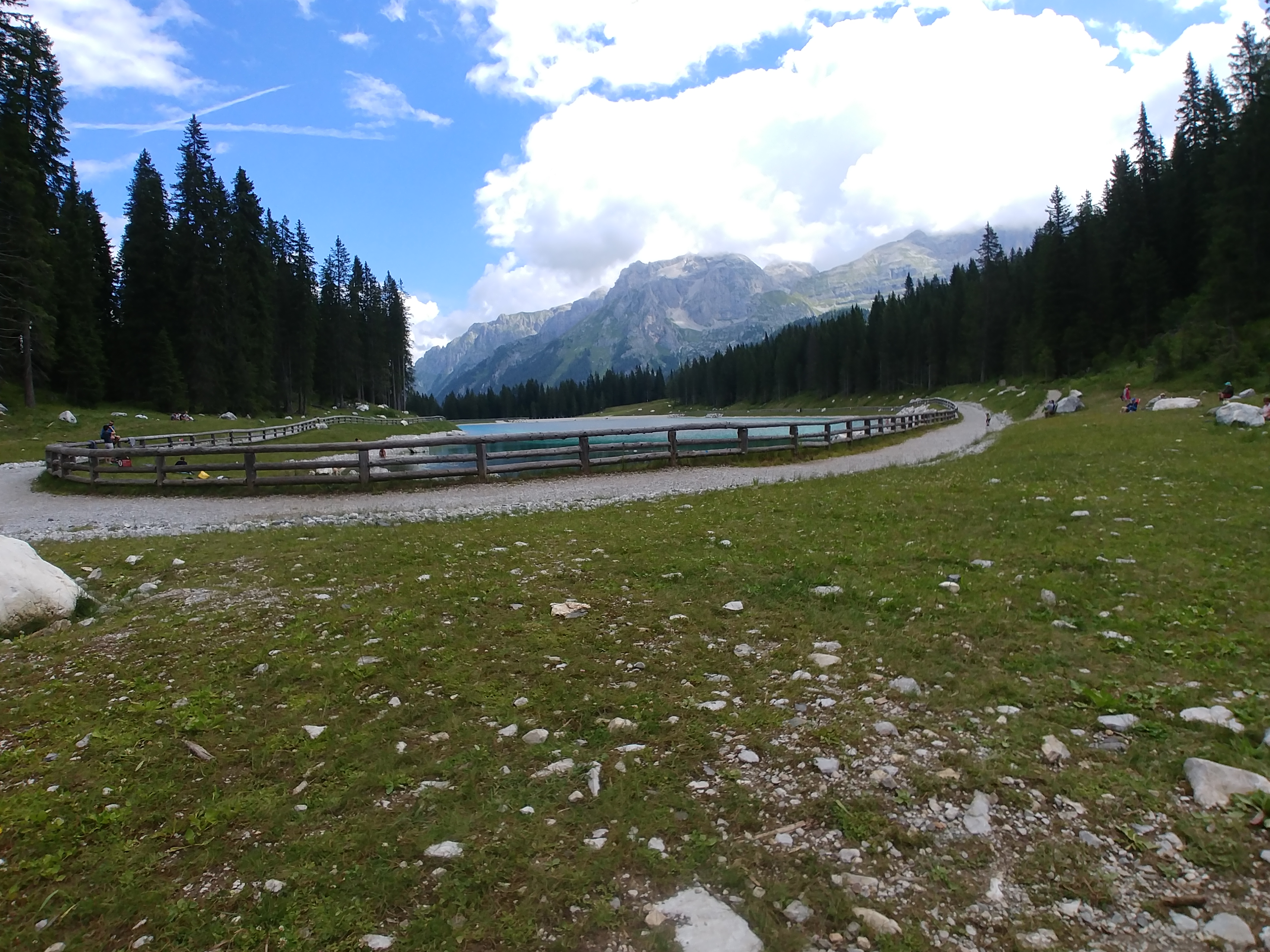
 Recently I strolled in Val Rendena. I noticed that Montagnoli lake is not visible on Google Earth so I decided to record my route from the parking near the Golf course to the lake.
For the recording of the track, I used GPS Logger 2.1.10. In short, as soon as I departed for the lake, I tapped on the lower right button labeled “Trackpoints” to start to record the track. Once at the lake I stopped the data collection tapping again on the “Trackpoints” button, I saved then the track tapping twice the tick mark on the upper right corner of the screen. 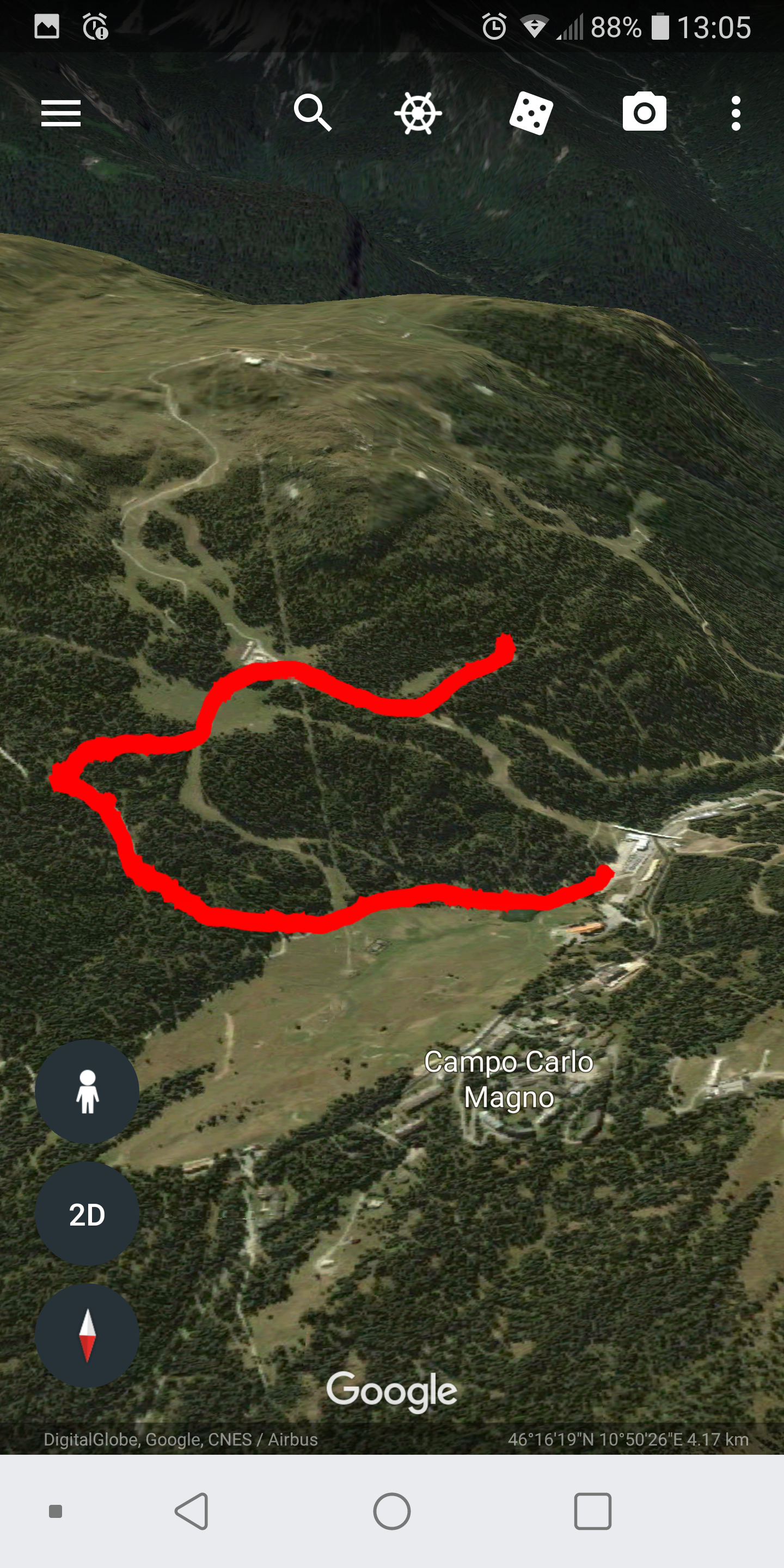
I visualized the track using Google Earth and Maps.me; the procedure is the same for both applications: hold down the finger on the track thumbnail and select “View in …”.
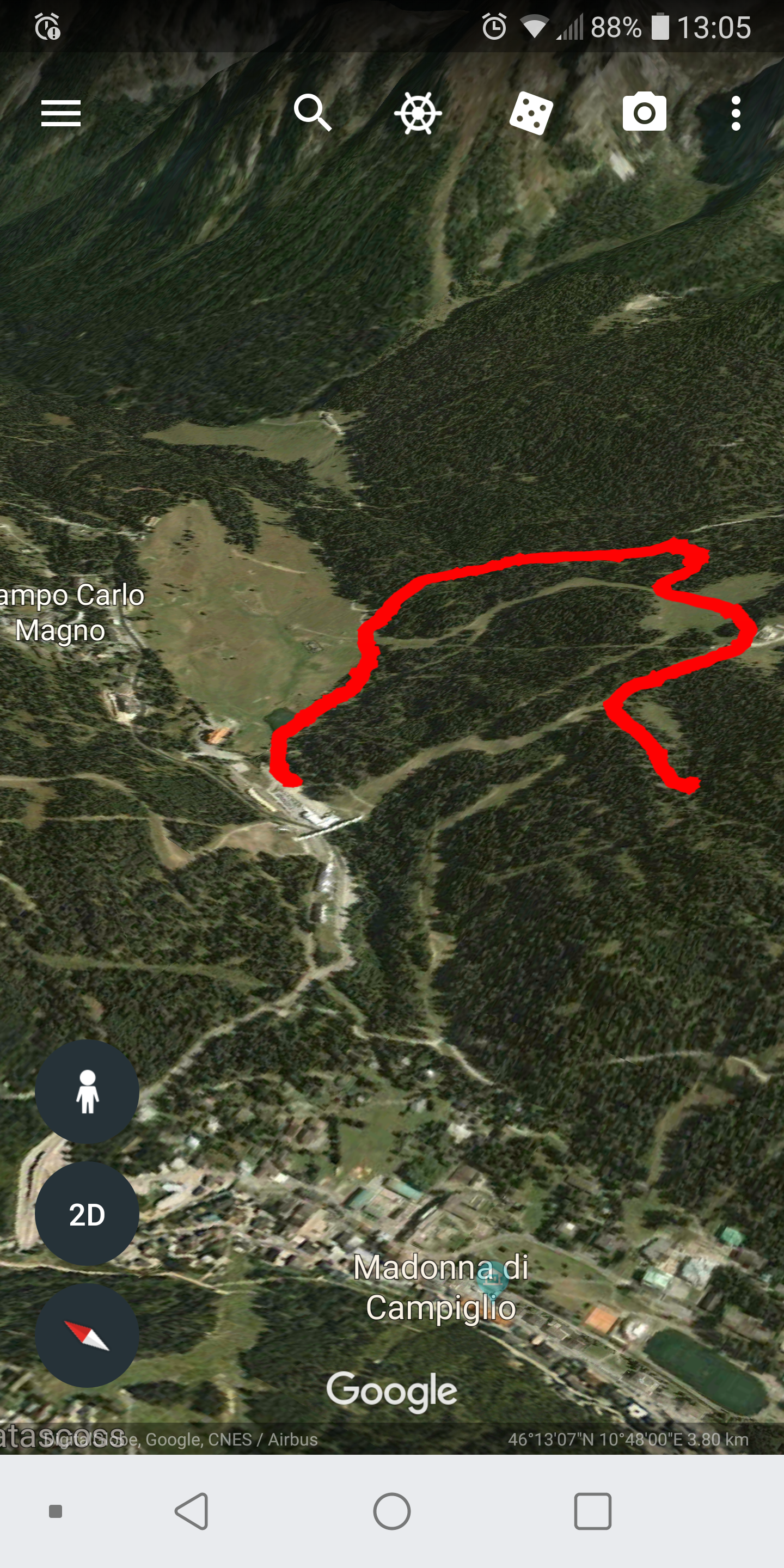
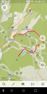
The track was good; I decided to export data to external files, hold down the finger on the track thumbnail and select “Export”. The exported files are stored on your phone within a “GPS Logger” folder. One file is in a plain TXT format, the second is in a KML format, and the third in GPX format. You select the GPX format, 1.0 or 1.1, from the settings menu of the app. Google Earth did not show the lake, on the contrary, Maps.me reported the position and the shape of the lake.
If you are not willing to browse your phone for exported files you can easily use the “Share with” function, that is selectable once you hold down your finger on the track, with this function you send to yourself or your friends an email or an IM.
Erik 2018