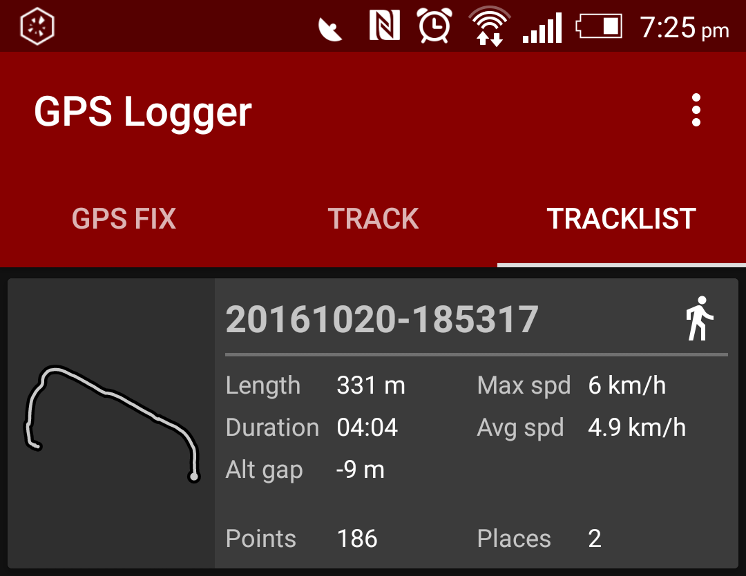
So you have downloaded and installed the application ‘GPS Logger’ on your phone and recorded some ‘Placemarks’ and/or ‘TrackPoints’.
In the example below, I recorded a short walk from my house to pub (in settings, I changed ‘collecting density’ to 1 meter) putting a Place Marker at the start and end of the walk.
1. Share the *.gpx data that you have just recorded with your computer by clicking on it and then clicking ‘Share with …’.
2. Open QGIS www.qgis.org on your computer.
3. If not already installed, install the ‘GPS Plugin’.
https://docs.qgis.org/2.0/en/docs/user_manual/working_with_gps/plugins_gps.html
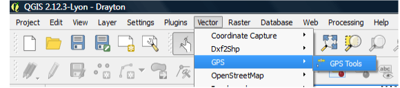
4. Click [Vector / GPS / GPS Tools] to open the ‘GPS Tools’ dialogue box.
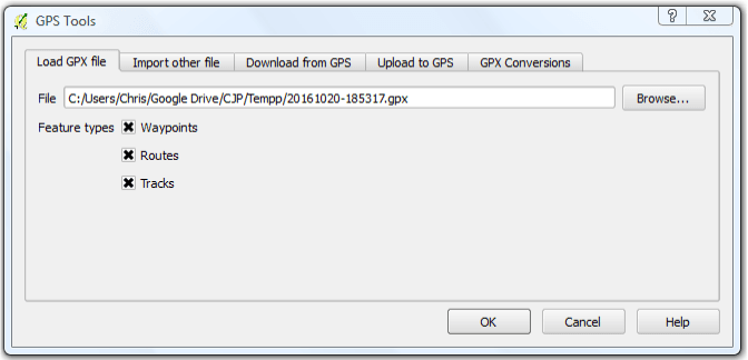
5. Browse to your *.gpx file and click OK.
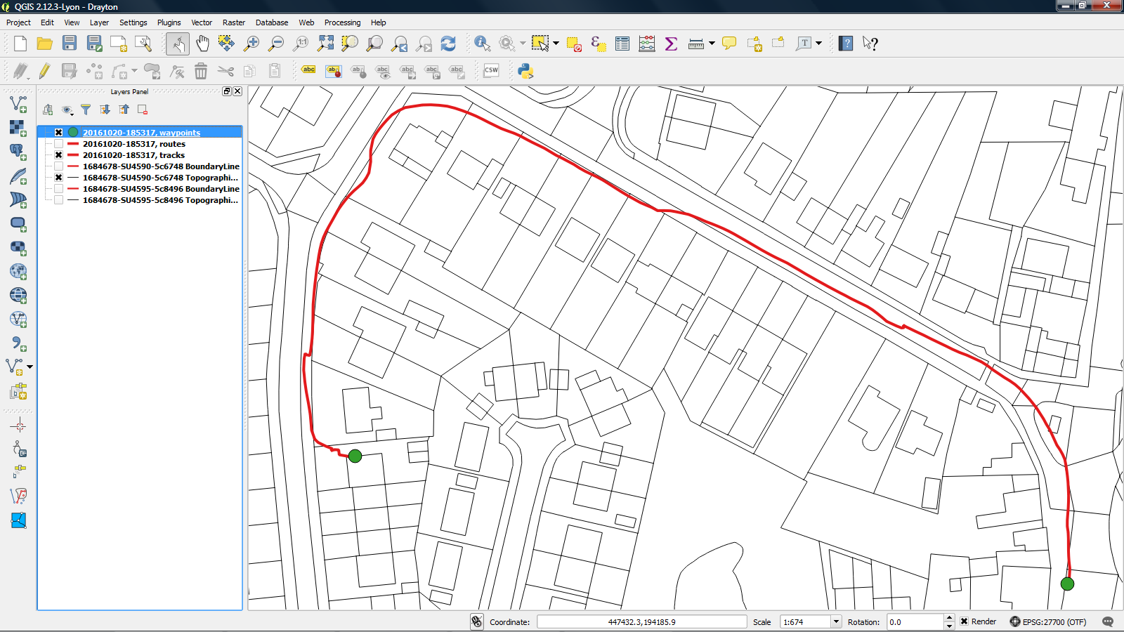
6. Your route is displayed. The ‘Placemarks’ are shown in green and ‘TrackPoints’ are shown in red.

7. You now need to add a base map. As I am from the UK, I use Ordnance Survey www.ordnancesurvey.co.uk and their ‘OS MasterMap’.
Chris Price, UK